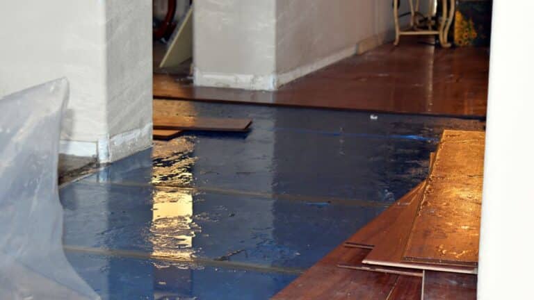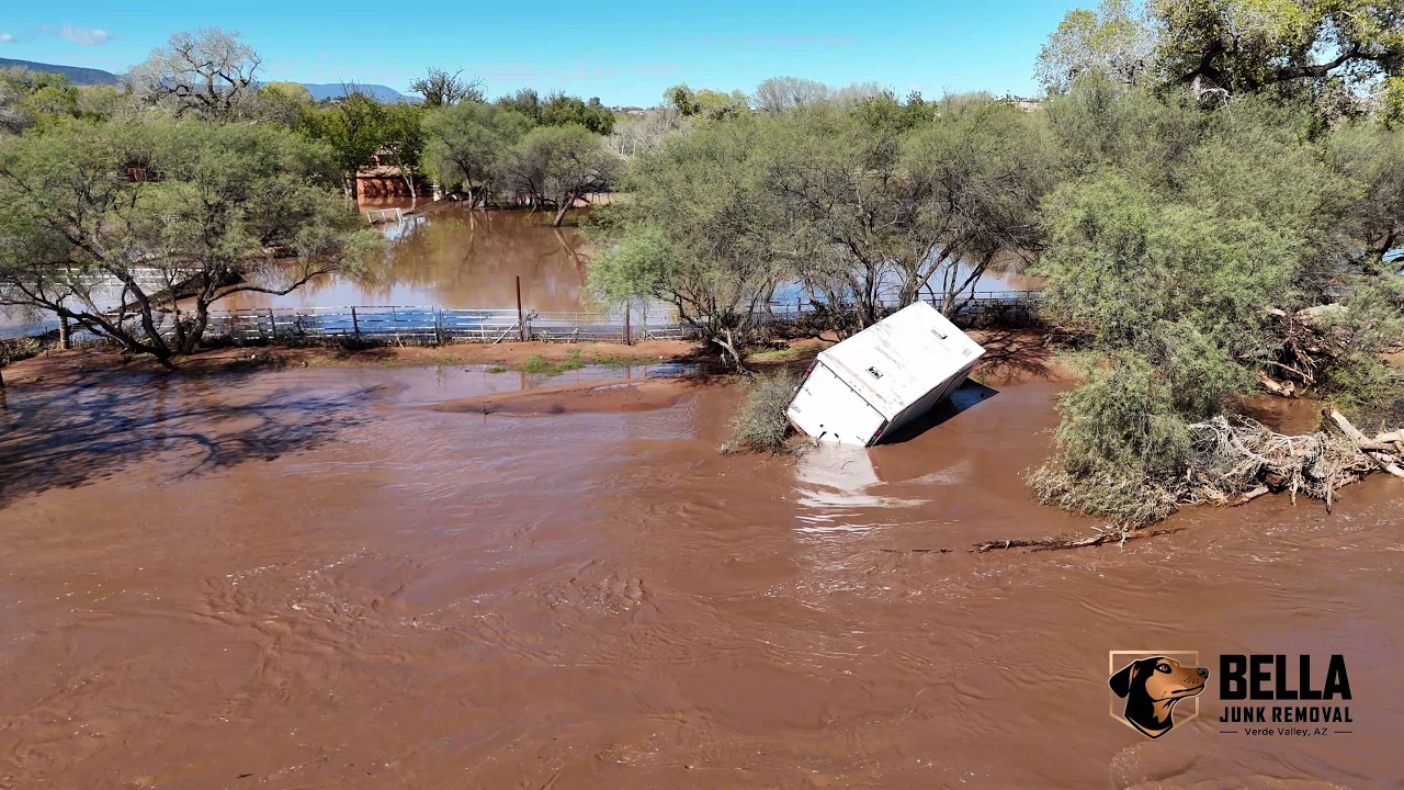
The Verde Valley flood 2026 hit our towns over the first weekend of November. The state of Arizona described it as 72 hours of historic rainfall that began Oct. 30 (KJZZ). The heaviest rain reached the Verde Valley Saturday night into Sunday, Nov. 1. By Sunday night the Verde River was far above flood stage at Camp Verde and Clarkdale, and Oak Creek near Cornville had passed its listed 1993 crest. We live and work here, so we put the facts, sources and local resources on one page for our neighbors.
These are early reports. River readings below are provisional USGS data and may change after review. Last updated: Nov. 2, 2026 (MST). For evacuation and access decisions, follow current official notices, not this dated article.
Verde Valley Flood 2026 at a Glance
| What | Reported figure | Source |
|---|---|---|
| Storm dates | Oct. 30 to Nov. 2, 2026 | KJZZ, citing the state |
| Heaviest Verde Valley rain total | 6.70 in. at Village of Oak Creek | NWS Flagstaff via Signals AZ |
| Verde above Camp Verde (USGS 09504950) | 24.65 ft, 55,500 cfs (flood stage 17 ft) | USGS, provisional |
| Verde near Clarkdale (USGS 09504000) | 23.82 ft, 45,000 cfs (flood stage 12 ft) | USGS, provisional |
| Oak Creek near Cornville (USGS 09504500) | 21.20 ft, above the listed 1993 crest of 19.15 ft | USGS, provisional; NOAA |
| Homes affected, Rimrock and Lake Montezuma | Estimated 150 to 200 | NWS via AccuWeather |
| Sedona homes evacuated | At least 19 (AZFamily) and more than 100 (KNAU) | Two reports, see below |
| People rescued in Sedona | About 40 | Sedona Fire via FOX10 |
What Happened, Oct. 30 to Nov. 2
The storm was an atmospheric river. AccuWeather reported flooding across the Southwest “from Friday through the weekend” (AccuWeather), and the state said the rain began Oct. 30 (KJZZ). The National Weather Service office in Flagstaff issued its first flood warning at 5:37 AM on Nov. 1 (Arizona Republic via Yahoo).
The ground was already wet. Weatherboy reported the soil was still saturated from a flood event just over a week earlier (Weatherboy), and the Prescott National Forest had closed the Clear Creek Day Use Area (Verde River access) on Oct. 26 (Prescott NF alerts).
Rainfall by town
The National Weather Service in Flagstaff published these totals the morning of Nov. 2. They cover the whole series of storms, not one day, and are named reporting sites, not whole-town measurements (Signals AZ).
| Location | Rain total |
|---|---|
| Village of Oak Creek | 6.70 in. |
| Slide Rock (Oak Creek Canyon) | 6.56 in. |
| Jerome | 3.79 in. |
| Clarkdale | 3.56 in. |
| West Sedona | 3.23 in. |
| Cottonwood | 2.94 in. |
| Camp Verde | 2.45 in. |
| Page Springs | 2.00 in. |
- The biggest totals fell upstream of Sedona, in Oak Creek Canyon and at the Village of Oak Creek, which helps explain why Oak Creek rose so fast.
- Crown King had 7.54 in. in the same NWS list. AccuWeather had reported 6.21 in. there earlier; the two figures cover different time windows.
- Flagstaff had 3.37 in. on Nov. 1, its wettest November day on record (AccuWeather).
- No official total was published for Rimrock, Lake Montezuma or Cornville.
How high the rivers got
These are the highest readings returned by a USGS query covering Oct. 30 to Nov. 2. They are provisional sampled maxima, not certified crests. Times are MST.
| USGS station | Highest stage | Highest flow |
|---|---|---|
| Verde near Clarkdale, 09504000 | 23.82 ft | 45,000 cfs (9 PM Nov. 1) |
| Verde above Camp Verde, 09504950 | 24.65 ft | 55,500 cfs (6:15 AM Nov. 2) |
| Verde near Camp Verde, 09506000 | 29.14 ft | 111,000 cfs (2:45 AM Nov. 2) |
| Wet Beaver Creek near Rimrock, 09505200 | 13.56 ft | 8,650 cfs (data stops 9:30 AM Nov. 1) |
| West Clear Creek near Camp Verde, 09505800 | 9.92 ft | 12,800 cfs (11:30 AM Nov. 1) |
| Oak Creek near Sedona, 09504420 | 18.83 ft | 22,600 cfs (9 PM Nov. 1) |
| Oak Creek near Cornville, 09504500 | 21.20 ft | 27,200 cfs |
Source: USGS instantaneous observations. Gaps in some series mean a station’s true peak may be higher.
Two Camp Verde gauges. The gauge the National Weather Service uses for the 17 ft flood stage near Camp Verde is USGS 09504950 (USGS calls it “above Camp Verde”). The historic downstream station, USGS 09506000, is where the 1993 flood of record was measured. Their stages can’t be compared with each other (USGS 09504950).
Is 29.14 ft at 09506000 a new record? We’re not calling it one. The stage is higher than the 1993 stage of 28.36 ft, but the flow, 111,000 cfs, is below the 1993 peak of 119,000 cfs, which points to a possible change in the gauge’s reference level or rating. USGS will review the data.
Oak Creek, 18 ft or 19.84 ft? KNAU reported Oak Creek at the Sedona gauge (09504420) near 18 ft and about 20,000 cfs (KNAU). The 19.84 ft reported by the Washington Post south of Sedona matches the downstream Cornville gauge (09504500) at 11:45 AM Nov. 1. That gauge later read 21.20 ft, above NOAA’s listed 1993 crest of 19.15 ft (NOAA). They’re different gauges, so the numbers don’t match.
More river details
- At Clarkdale, 23.82 ft is the second-highest stage on record for that gauge, behind 26.39 ft in February 1993 (USGS peaks).
- Verde Valley Fire Chief Danny Johnson told 12News he was seeing record flows on every flood gauge on the streams that feed the Verde (12News).
- The Camp Verde Marshal’s Office, as quoted by FOX10, said the Verde rose “roughly 50 feet past normal levels” (FOX10). That is a quote, not a gauge reading. The USGS stages above are the measured levels.
Damage reports so far
No official damage assessment count for the Verde Valley has been released. These are the reported figures so far, each attributed:
- Rimrock and Lake Montezuma: an estimated 150 to 200 homes affected along Wet Beaver Creek, per the National Weather Service (AccuWeather).
- Camp Verde area: more than a dozen homes flooded and destroyed (AZFamily).
- Statewide: the state said seven counties and five tribal nations were affected (KJZZ).
Camp Verde: Verde River, White Bridge and Clear Creek
Camp Verde got an immediate evacuation notice around 2:45 PM on Nov. 1 (KTAR). GO orders covered areas along the Verde River, West Clear Creek and Wet Beaver Creek (Yavapai-Apache Nation).
The National Weather Service describes what these stages mean near Camp Verde: at 17 ft, water starts flooding sites and the lower road at Verde River RV Resort; at 19 ft, flooding begins in the Horseshoe Bend area and homes downstream to Beasley Flat begin to flood; at 21 ft, homes are inundated from Horseshoe Bend to Beasley Flat. The river passed all three.
A Camp Verde area resident told AZFamily a nearby creek rose 20 ft in about 7 minutes. Verde Valley Fire made at least a dozen swift water rescues on Sunday (12News).
Rimrock and Lake Montezuma
Wet Beaver Creek flooded Rimrock and Lake Montezuma. AZFamily described downed trees, debris wrapped around semi trucks and roads fully underwater. Yavapai County issued GO orders for Rimrock on Nov. 1 (KNAU).
This area has flooded before. In February 2019, the Montezuma Castle gauge on Wet Beaver Creek rose 15 ft in two hours and about 25 homes were damaged (Yavapai County Flood Control).
Sedona and Oak Creek
Sedona Zones 8, 9 and 10 moved to SET and then GO on the morning of Nov. 1. The zones include Trails End, Purtymun Ln, Lomacasi, Arroyo Roble, Blackhawk Ln, Oak Creek Mobilodge, Sycamore Rd, Poco Diablo, Rancho Sedona RV and Bear Wallow Ln (FOX10).
Sedona evacuation counts: 19 or more than 100? AZFamily, citing a Yavapai County spokesman, reported at least 19 evacuated homes along Oak Creek (AZFamily). KNAU reported more than 100 homes evacuated in Sedona (KNAU). The reports don’t use the same boundary or cutoff time, and no official source has reconciled them, so we show both. Neither is a count of damaged homes.
Sedona Fire rescued about 40 people (FOX10). Residents began returning at 4:45 PM on Nov. 2 with proof of residency. Blackhawk Ln, Trails End Dr and Ln, and Bear Wallow Ln remain closed until conditions are safe (FOX10).
Cornville, Cottonwood and Clarkdale
- Cornville: GO for the Lower Oak Creek neighborhoods (AZFamily). The Cornville gauge passed its listed 1993 crest.
- Cottonwood: GO for the Bates Rd, Comanche, Franquero and Rivera Run Dr areas (FOX10).
- Clarkdale: GO orders issued Nov. 1 (KNAU). NWS notes that at 15 ft on the Clarkdale gauge, the River Day Use Area at Dead Horse Ranch State Park and homes on Bates Rd flood, and at 20 ft there is widespread flooding of low lying homes. The river reached 23.82 ft.
Emergency declarations
- Yavapai County’s Board of Supervisors declared an emergency on Nov. 2 (Signals AZ).
- Camp Verde, Sedona and Prescott declared their own emergencies (KJZZ).
- Gov. Katie Hobbs declared a statewide state of emergency on Nov. 2 and released state emergency funds to the Arizona Division of Emergency Management (KJZZ).
Timeline (MST)
| When | What happened |
|---|---|
| Mon Oct. 26 | Prescott NF closes Clear Creek Day Use Area after earlier flooding |
| Fri Oct. 30 | Atmospheric river rain begins across Arizona |
| Sun Nov. 1, 5:37 AM | NWS Flagstaff issues its first flood warning |
| Nov. 1, morning | Sedona Zones 8 to 10 go to SET, then GO |
| Nov. 1, about 2:45 PM | Camp Verde immediate evacuation notice |
| Nov. 1, evening | GO for Rimrock, Camp Verde, Clarkdale; Oak Creek near Sedona peaks near 18.8 ft |
| Mon Nov. 2, 2:45 AM | Verde near Camp Verde (09506000) reaches 111,000 cfs |
| Nov. 2 | County and state emergency declarations |
| Nov. 2, 4:45 PM | Sedona residents begin returning |
Drone Footage: White Bridge Picnic Site and Clear Creek Campground
Drone footage filmed Nov. 2, 2026 at White Bridge Picnic Site and Clear Creek Campground, Camp Verde. Watch on YouTube.
Nate flew our drone over two spots near Camp Verde to document the flood for neighbors, from a safe distance. Please don’t visit closed sites to see the water for yourself.
White Bridge Picnic Site on the Verde River
White Bridge sits at Highway 260 just past the Verde River bridge in Camp Verde. It is managed by the Coconino National Forest; the Prescott National Forest also lists it and notes that Coconino manages it (Coconino NF, Prescott NF). We found no dated post-flood reopening notice, so check Forest Service alerts and obey posted closures before you go.
Clear Creek Campground
The Coconino National Forest closed Clear Creek and Clear Creek Group Campgrounds and the Clear Creek Day Use Picnic Site in its Nov. 2 alert, with no end date (USFS).
Verde Valley Flood 2026 Compared With Past Floods
This flood is being compared with the great flood of February 1993. Here is how the big Verde Valley floods stack up. Readings are from USGS annual peak records unless noted, and each row names its gauge.
| Date | What the record shows | Source |
|---|---|---|
| Mar. 1938 | Verde near Camp Verde (09506000): 26.10 ft, 97,000 cfs | USGS |
| Feb. 20, 1993 | The flood of record. 09506000: 28.36 ft, 119,000 cfs. Clarkdale (09504000): 26.39 ft, 53,200 cfs | USGS |
| Mar. 1995 | 09506000: 24.25 ft | USGS |
| Feb. 12, 2005 | 09506000: 22.15 ft, 62,000 cfs. Clarkdale: 17.94 ft, 27,000 cfs | USGS |
| Feb. 2019 | 09506000: 22.19 ft, 52,700 cfs. Wet Beaver Creek flooded Rimrock; about 25 homes damaged | USGS; Yavapai County |
| Aug. 18 to 19, 2021 | Monsoon flood. Clarkdale rose from 1.91 to 19.49 ft in 58 minutes | NWS |
| Nov. 1 to 2, 2026 | 09506000: 29.14 ft, 111,000 cfs. Clarkdale: 23.82 ft, 45,000 cfs (provisional) | USGS |
Sources: USGS peaks, 09506000; USGS peaks, 09504000; NWS August 2021 summary; Yavapai County Past Flood Events.
Was 2026 the biggest flood? There’s no single valley-wide answer yet. By flow, 1993 is still the benchmark at both Clarkdale and Camp Verde. The Cornville gauge on Oak Creek passed its listed 1993 crest, and the Camp Verde stage was higher than in 1993 even though the flow was lower. USGS review will settle the final numbers.
How to Check the Verde River Level and Oak Creek Flow
- USGS gauges at waterdata.usgs.gov: Verde above Camp Verde, the 17 ft flood stage gauge (09504950); Verde near Camp Verde (09506000); Verde near Clarkdale (09504000); Oak Creek near Sedona (09504420); Oak Creek near Cornville (09504500); West Clear Creek (09505800); Wet Beaver Creek (09505200).
- NWS Flagstaff for warnings and forecasts.
- Yavapai Ready for evacuation alerts.
Flood Safety in the Verde Valley
- Turn around, don’t drown. Never drive or walk through a flooded road or low water crossing, and stay out of GO zones until there is an all clear.
- Check closures before visiting. The Coconino NF closed many Red Rock sites, including Crescent Moon, Grasshopper Point and the West Fork Trail, plus the Red Rock Ranger Visitor Center (USFS).
- Roads: SR 89A closed between Sedona and Kachina Village with debris, damaged guardrails and washed out pavement (AZFamily). Check AZ511 for current status.
Local Resources: Alerts, Sandbags, Shelters
- Shelter: FOX10 reported a temporary shelter at the Camp Verde Parks and Rec Gym, 473 Main St. A shelter also opened at Sedona Red Rock High School (AZFamily). Confirm before going.
- Camp Verde sandbag sites: Fain & Nichols, Camp Verde Water Company, Yavapai County Complex (FOX10).
- Donations: check the organizer and beneficiaries before giving to any fundraiser.
- Schools: CVUSD planned to reopen Tue Nov. 3 (CVUSD).
Flood recovery help for Camp Verde businesses and residents
On Nov. 3, 2026, the Town of Camp Verde said it is measuring how hard the flood hit local businesses. That count is the first step toward State and Federal disaster relief funding (Town of Camp Verde).
- Every Camp Verde business is asked to fill out the Flood Damage Assessment Survey soon.
- Fill it out even if you had no physical damage but lost revenue. Blocked roads, evacuation orders, staff who couldn’t get to work and canceled bookings all count.
- Share the survey with other Camp Verde businesses that were hit by the flood.
- The Town’s flood recovery page is the one place for safety updates and relief programs. It will be updated as more information comes in.
- Yavapai County runs an emergency information phone bank at (928) 442-5103 (Town of Camp Verde).
- For road closures, water levels and safety alerts, follow the official social media channels of the Town of Camp Verde and the Camp Verde Marshal’s Office.
- Questions about the survey or the Town’s relief work: Ryan Wissmann, Economic Development Program Manager, ryan.wissmann@campverde.az.gov or (928) 554-0053.
Flood recovery help for Sedona businesses and residents
As of Nov. 3, 2026, the Greater Sedona Chamber of Commerce keeps a flood resource page for businesses with city, county, state and federal contacts. The City of Sedona has its own flood recovery page for residents.
- The City of Sedona and the Yavapai County Board of Supervisors each declared an emergency on Nov. 2 (Sedona Chamber, City of Sedona).
- Governor Hobbs declared a statewide State of Emergency on Nov. 2 (Office of the Arizona Governor).
- As of Nov. 3, SBA disaster loans for this flood are not active yet. They may become available if the state requests help and SBA issues a declaration (Sedona Chamber). Check SBA disaster assistance for who qualifies.
- As of Nov. 3, 2026, SR 89A is closed between Sedona and Kachina Village (mileposts 375 to 397) with no reopening estimate. Check az511.gov before you drive.
- Restaurants and food businesses in the Coconino County part of Sedona hit by flooding or wastewater overflow should call Coconino County Environmental Health before reopening: (928) 679-8760 or the main line (928) 679-7272 (Sedona Chamber).
- Tlaquepaque is welcoming visitors back while cleanup continues. Some shops and restaurants are still working toward reopening (Visit Sedona).
- West Fork Trail is closed for the foreseeable future (Coconino National Forest).
Flood Cleanup and Disposal
As of the evening of Nov. 2, we had not found official residential flood-debris guidance from Yavapai County, the Town of Camp Verde or the City of Sedona. Call any transfer station before loading up to confirm storm access, hours and what they accept. Yavapai County keeps substantial-damage guidance for repairs in the floodplain. For disposal options, see our landfills and transfer stations page. For step-by-step help with safety, insurance photos, drying, mold and what to throw away, see our flood cleanup guide.
How Bella Junk Removal Can Help Neighbors
Bella Junk Removal is a family owned junk removal company based in Camp Verde. We live here, and this flood hit people we know. Our crew serves Camp Verde, Sedona, Cottonwood, Clarkdale, Cornville and Rimrock.
If you need help hauling out furniture, carpet, drywall, yard debris or other property cleanout items damaged by the flood, call (928) 395-6441 or contact us.
Our flood debris removal page explains what we haul after a flood and how it works.
FAQ
How high did the Verde River get in 2026?
At the flood stage gauge above Camp Verde (USGS 09504950), the river reached a provisional 24.65 ft against a 17 ft flood stage. At Clarkdale it reached 23.82 ft against a 12 ft flood stage, the second-highest stage on record there after 26.39 ft in February 1993.
Was this a record flood?
On Oak Creek at Cornville, the provisional 21.20 ft passed the listed 1993 crest of 19.15 ft. On the main Verde, 1993 is still the highest flow at Clarkdale and Camp Verde. Final comparisons will follow USGS review.
When did the 2026 Verde Valley flood start?
The state said the rain began Oct. 30. The heaviest rain hit the Verde Valley Saturday night, Oct. 31, into Sunday, Nov. 1, when most evacuations were ordered. Rivers began falling late Nov. 1 into Nov. 2.
How many homes were damaged?
No official count has been released. The National Weather Service estimated 150 to 200 homes affected in Rimrock and Lake Montezuma, and AZFamily reported more than a dozen homes flooded and destroyed in the Camp Verde area.
How can I check the Verde River level near Camp Verde?
Use the USGS gauge Verde River above Camp Verde (09504950), which matches the NWS 17 ft flood stage, plus National Weather Service Flagstaff alerts and Yavapai Ready.
Are White Bridge and Clear Creek Campground open after the flood?
The Coconino National Forest closed Clear Creek Campground in its Nov. 2 alert. We found no dated reopening notice for White Bridge. Check Forest Service alerts before visiting.
Where can I get sandbags in Camp Verde?
FOX10 listed Fain & Nichols, Camp Verde Water Company and the Yavapai County Complex.
Who can help with flood debris in Camp Verde?
Bella Junk Removal can haul items damaged by the flood anywhere in the Verde Valley. Call (928) 395-6441.
This article is general information, not legal, insurance or safety advice. Road closures, evacuation zones and river levels change fast, and what’s here may already be out of date. Check AZ511, Yavapai County, Coconino County and your town’s official channels before you travel or go home. Information was current as of November 2026.
Sources
- KJZZ, statewide emergency, Nov. 2
- Signals AZ, NWS rain totals, Nov. 2
- AccuWeather
- USGS instantaneous observations
- USGS peaks, 09506000 and 09504000
- NOAA Cornville gauge
- NWS August 2021 summary
- KNAU, Nov. 2
- 12News
- FOX10 Camp Verde
- FOX10 Sedona
- FOX10 Sedona, Nov. 2
- AZFamily, Sedona
- AZFamily, Camp Verde
- KTAR, evacuation orders
- Weatherboy
- Coconino National Forest alert
- Yavapai County, Past Flood Events
- Town of Camp Verde, flood recovery page and business survey, Nov. 3
- Greater Sedona Chamber, business flood resources, Nov. 3
- City of Sedona, flood recovery information, Nov. 3
- Office of the Arizona Governor, State of Emergency, Nov. 2
- SBA disaster assistance
- ADOT AZ511 road conditions
- Visit Sedona, flooding update, Nov. 3
- Coconino National Forest, West Fork Trail closure